![[object Object]](https://umsousercontent.com/lib_heZDZMqkJicLuLKJ/igzynodna381foma.png?w=358)
One of the most mysterious terms in NSW planning is “accessible area”. Have you ever seen a map of what constitutes an accessible area… No?
An accessible area is defined in the Housing SEPP as land within:
- 800m walking distance of
- a public entrance to a railway, metro or light rail station, or
- for a light rail station with no entrance—a platform of the light rail station, or
- a public entrance to a wharf from which a Sydney Ferries ferry service operates
- or 400m walking distance of a bus stop used by a regular bus service, within the meaning of the Passenger Transport Act 1990, that has at least 1 bus per hour servicing the bus stop between
- 6am and 9pm each day from Monday to Friday, both days inclusive, and
- 8am and 6pm on each Saturday and Sunday.
The effects of accessible area in the planning controls are:
- Unlocks the infill affordable housing bonus height/FSR;
- Boarding house and co-living are prohibited in R2 zone in Sydney/Central Coast if not in accessible area;
- Affects required parking for boarding houses, co-living, and build-to-rent;
- Affects when residential development can be carried out without consent by an authority.
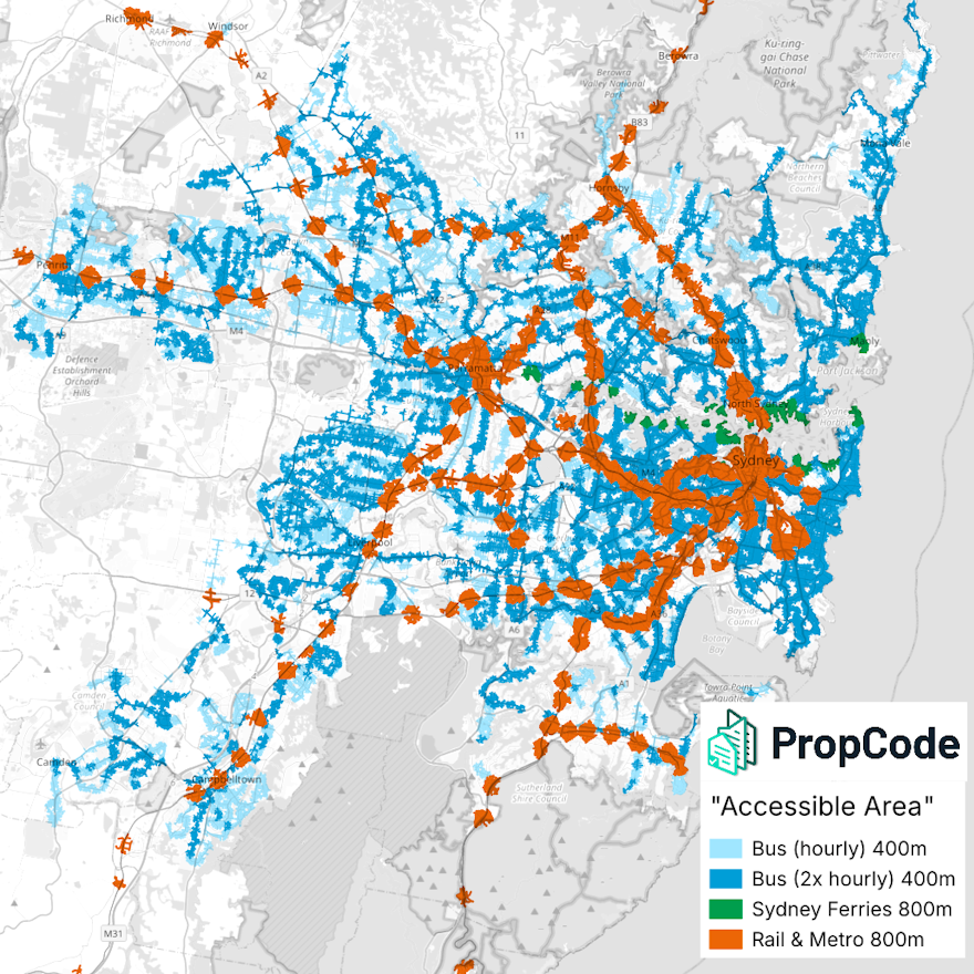
To satisfy my own curiosity, I did the hard work to grab these station locations and timetables and extract the qualifying bus stops. In total there are over 13,000 rail, ferry, and bus stops that qualify!
I then calculated walking distance from each of these to get the area defined as “accessible area”. See the attached map for the result.
I was also curious whether a higher standard of bus frequency (2x per hour) would make a difference, and the answer is yes, a massive difference in some suburban areas (light blue is <2x per hour). Let's be honest - if the only available public transport is an hourly bus, that's not very accessible.
I've now added this map into PropCode's database, so our auto-generated DA reports will correctly analyse the planning rules described above. Try it today for your residential project with our Rapid Planning Report tool.