![[object Object]](https://umsousercontent.com/lib_heZDZMqkJicLuLKJ/igzynodna381foma.png?w=358)
Menu
- Our Platform
- Pricing
- Contact Us
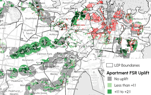
Do you need to understand the impacts of the NSW Low and Mid Rise rules on your property?
Fill in the form below to instantly receive an email with FREE analysis for your property plus a FREE video with expert commentary.
To get bulk LMR datasets, click here: https://propcode.com.au/data-extraction
Submit this form to instantly receive for FREE:
- a detailed analysis of LMR/TOD rules on your property;
- a link to a webinar explaining the LMR reforms in detail.
(Please check here first to get the exact title ID for your property: https://app.propcode.com.au/title)
PropCode uses advanced algorithms to codify the planning regulation changes, identify impacted zones, and calculate changes individually per property. Our platform's database includes: